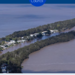
Council-under-administration has released a flood map for Tuggerah lakes. The interactive online flood mapping tool for Lake Munmorah, Budgewoi Lake and Tuggerah Lake, draws on current and predicted flood levels directly from the Bureau of Meteorology and converts it into a visual display to show the extent of flooding. You can search your property, and see the impacts of … [Read more...] about App maps potential impact of floods
Watching Central Coast Council on behalf of fair-minded and reasonable people.
Central Coast Council Watch

Footer

Merilyn Vale – Journalist
This page is run by journalist Merilyn Vale and is not associated with Council.

Recent
- June 23 meeting July 5, 2025
- Bangaloe subdivision approved July 5, 2025
- Burns Place Conservation Plan open for feedback June 25, 2025
- Court on site at Wards Hill Rd for talks on telecom tower June 14, 2025
- Mardi Old Farm gets subdivision approval June 7, 2025
Search
Tags
Administrator
airport
ALGA
ARIC
Austin Butler
Boarding house
bowling club
candidates
Central Coast
Central Coast Council
Central Coast Council Watch
Central Coast NSW
CMP
Community land
COSS
DAs
Davistown
dogs
East Gosford
elections
Elections 2024
Expenses
Gosford
Gosford waterfront
IPART
LEC
LGNSW
LPP
NSW
NSW council elections
politics
Rates
seawall
Six Cities Commission
TAFE
ten questions
The Entrance
Tuggerah Lakes
Umina Beach
Wadalba East
Wamberal Beach SOS
Wamberal seawall
Warnervale
Water and Sewer
Wyong
